
Historical field analysis
Battlefields1560Nagoya and Toyoake, Aichi
Reading Okehazama
Testing a Famous Battle Against the Ground
The first time I visited Okehazama, I went looking for the place where Imagawa Yoshimoto died. The second time, I went looking for a battle.
8 September 2026Noah Schuster · 11 min read
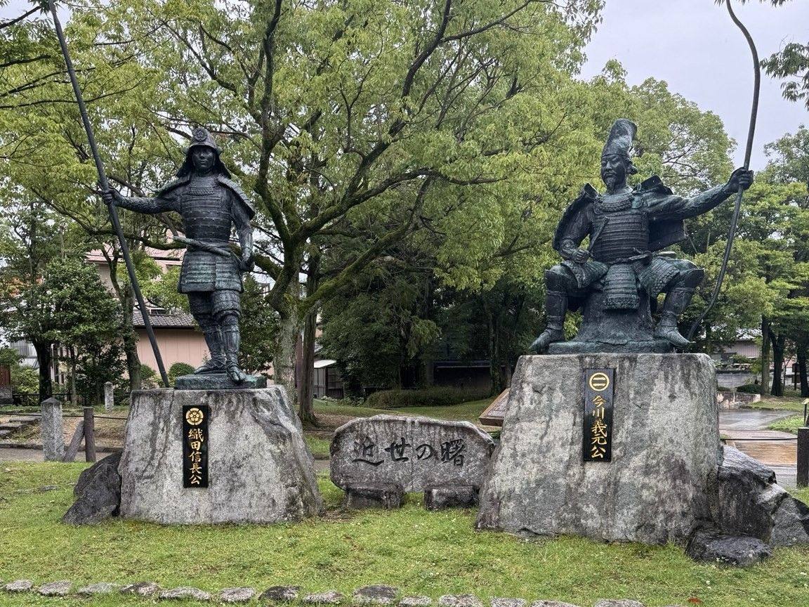
On September 8, 2026, I returned to the southeastern edge of Nagoya with a different purpose. I already knew the story that made Okehazama famous: Oda Nobunaga, heavily outnumbered, advancing against Imagawa Yoshimoto; violent weather; a sudden attack; Yoshimoto dead; and the political future of central Japan altered in a matter of hours. The Battle of Okehazama, fought on June 12, 1560, is one of the defining episodes of the Sengoku period. It is also considerably harder to understand once you begin walking the ground on which it happened. 2
That afternoon, the rain was relentless. This was not light weather giving a historical site atmosphere. At 4:53 p.m., the Nagoya Local Meteorological Observatory recorded 104.5 millimeters of rain in one hour, exceeding the city's previous one-hour record from the 2000 Tokai heavy rain and setting a new record in observations dating to 1890. A linear rainband had developed over Aichi and Gifu. 1
The coincidence was impossible to ignore. Weather has occupied a central place in accounts of Okehazama for centuries, and I had returned specifically to examine the battlefield while another major storm was passing over the city. I was careful not to confuse the two. A storm in 2026 could tell me nothing definitive about the weather of 1560. What it could do was make one tactical problem immediately tangible: visibility disappears quickly. Noise changes. Footing deteriorates. Slopes become more difficult. Soldiers do not move across clean arrows on a map; they move through weather, vegetation, broken terrain, and other men.
A battlefield hidden inside a neighborhood
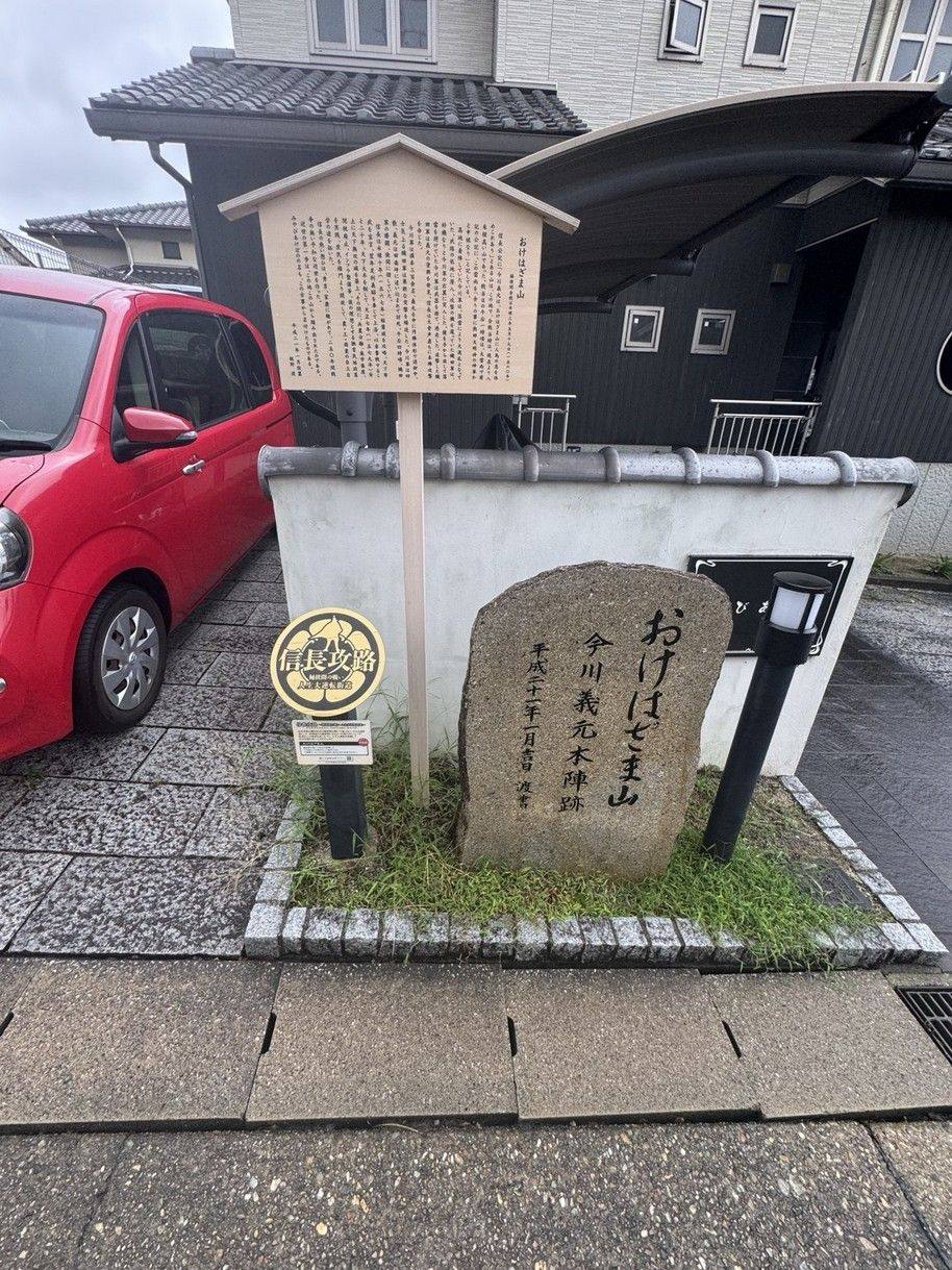
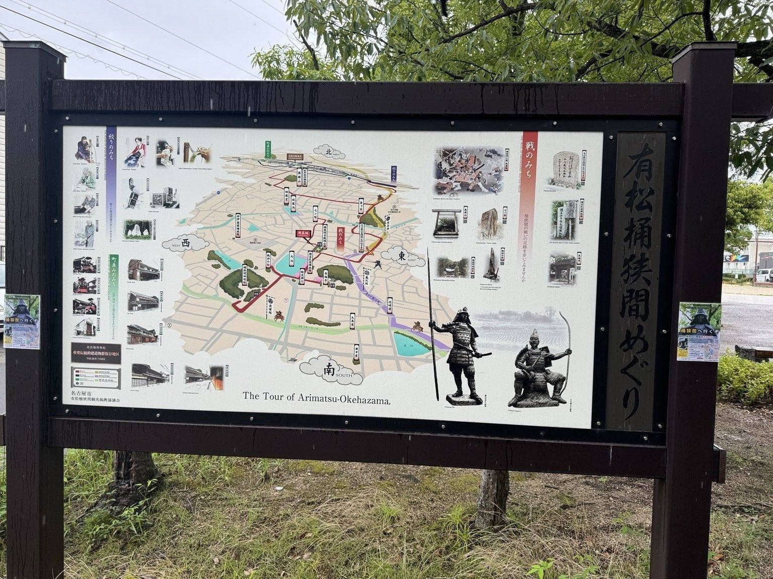
There is no preserved battlefield stretching untouched across Okehazama. The modern landscape is houses, paved roads, retaining walls, parking lots, temples, and small fragments of open ground. Historical markers appear almost unexpectedly between ordinary buildings. At first, that makes the battle more difficult to imagine. Then the elevations begin to reveal themselves. A road rises. Another drops. A wooded ridge interrupts the view. What looks close on a map may disappear behind the terrain when approached on foot.
This became especially important around Okehazama-yama, identified in Nagoya's local interpretation as the area where Yoshimoto rested his men, and Kamagatani, associated with Nobunaga's force immediately before the decisive attack. 2
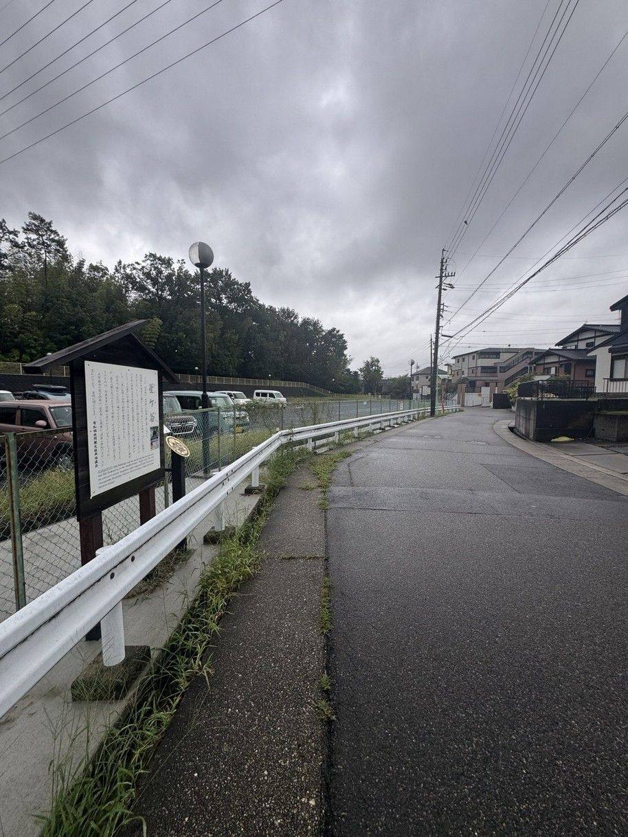
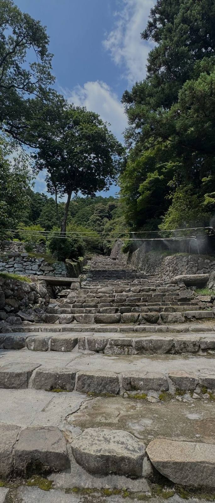
My immediate reaction to Kamagatani was skepticism. The ground was hilly, but not mountainous by any reasonable definition. It rose and fell enough to affect sightlines and movement, but I did not see an obvious place where a large body of troops could simply vanish. If Nobunaga's men were concealed here before the attack, how much concealment did the landscape actually provide?
The problem is that I was looking at a battlefield more than four and a half centuries later. Roads have been cut, houses built, slopes altered, fields drained, and vegetation removed and replanted. I could not treat modern Okehazama as a perfect copy of the terrain of 1560. Even so, the area did not feel like a dramatic mountain ambush site. It felt like broken, rolling ground: enough to interrupt visibility, perhaps, but not enough to make concealment automatically convincing.
That distinction matters because the older image of Nobunaga making an elaborate concealed detour has been challenged by modern scholarship. Historian Fujimoto Masayuki argued from the Shinchō-kōki that Nobunaga's movement was better understood as a more direct attack, and his work helped move the debate away from the once-dominant flanking-ambush narrative. 3
The landscape did not settle that debate for me. It did something more useful: it made the debate physically understandable. The terrain was complicated enough to matter, but not so dramatic that one explanation became inevitable.
Chōfuku-ji: where the battle became memory
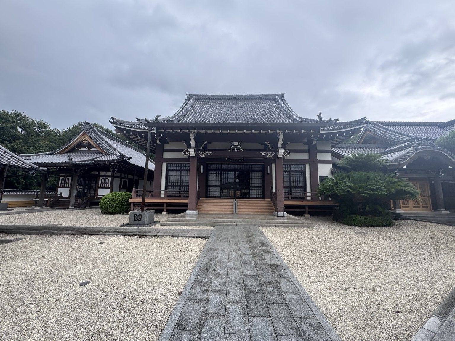
From the terrain around Kamagatani, I moved to Chōfuku-ji. The temple changed the character of the visit almost immediately. Until then, I had been thinking in military terms: elevation, visibility, routes of approach, and whether the ground could realistically conceal movement. Chōfuku-ji presented a different problem. Here, Okehazama was preserved not mainly through terrain, but through tradition.
The temple was founded in 1538. Nagoya's official local-history material records that Hayashi Ami, an associate of Yoshimoto, later dedicated an Amida image for his lord's repose, and the temple preserves wooden images of Yoshimoto and Matsui Munenobu. On-site interpretation also relates the tradition that the temple received and refreshed Imagawa men before the battle. 2
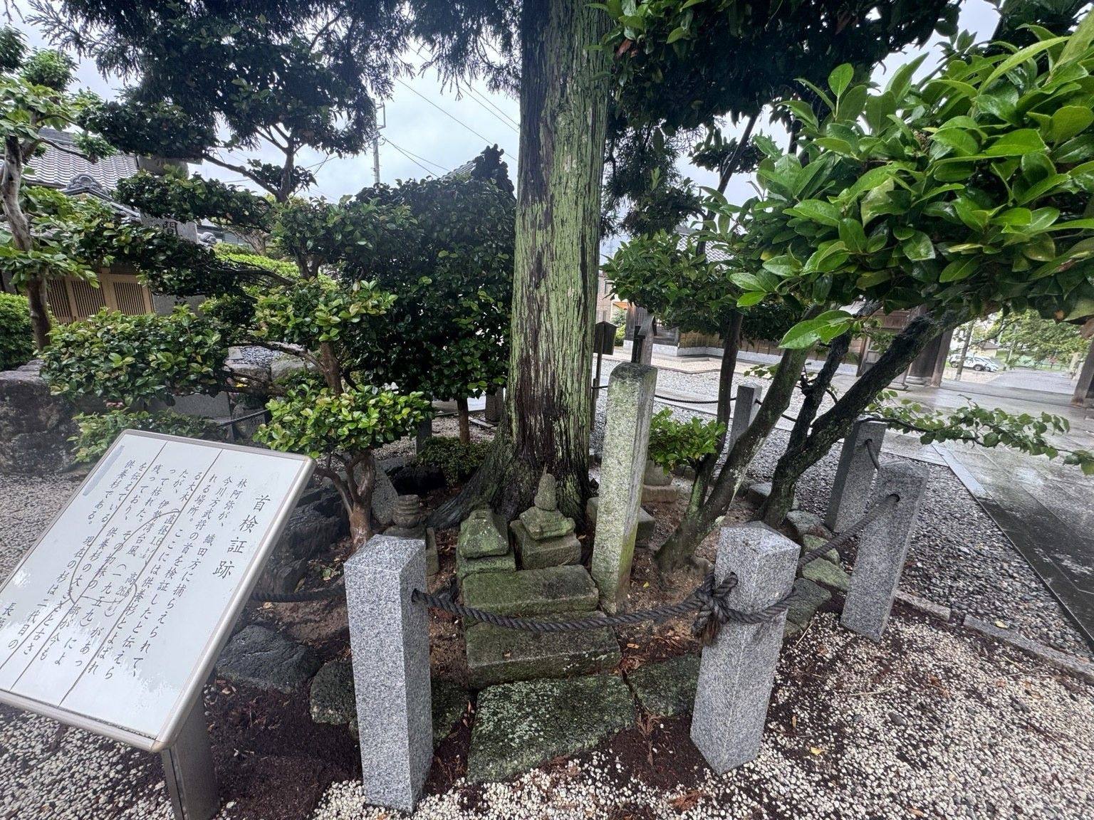
One of the most striking places on the grounds is marked kubijissho-ato, the traditional site associated with the identification of severed heads after the fighting. Temple interpretation holds that Hayashi Ami was made to identify fallen Imagawa officers. Standing there made the aftermath of Okehazama considerably harder to romanticize. Battlefield histories reduce victory to arrows: one force advances, another breaks, a commander dies. A head-identification tradition strips away some of that abstraction. If the memory reflects what occurred, these were not anonymous casualties. They were men known well enough that someone could be asked to give them names. 7
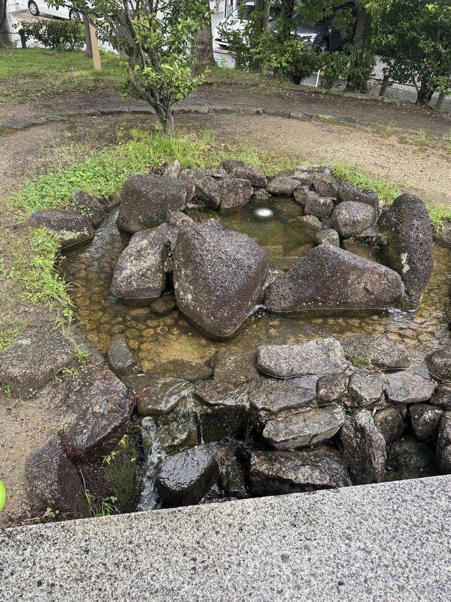
Nearby, Benten Pond carries another layer of memory. An on-site sign identifies it as a release pond connected with Benzaiten and notes that Edo-period sources called it a place where bloodied blades were washed. On an earlier visit, a local woman told me a more vivid version: that severed heads had been washed in the water around the rocky area of the battlefield park. I could not verify her claim, and Nagoya's official description of the spring at the battlefield park instead calls it Yoshimoto's water-drawing spring. The story still mattered, not as proof, but as evidence of how local memory continues to attach itself to the landscape. 7
By that point, almost every location seemed to demand two questions rather than one: What happened here in 1560? And when did people begin saying that it happened here? Those are not the same question. A tradition may preserve genuine memory. It may also preserve generations of interpretation layered onto the event. Okehazama requires both possibilities to remain visible.
Where did Yoshimoto die?
The most difficult question at Okehazama should have been the simplest: where, exactly, did Imagawa Yoshimoto die? I had already encountered two answers.
On an earlier visit, a local woman had pointed me toward Okehazama Battlefield Park in Nagoya. She was confident that Yoshimoto had been killed there, around the rough stone-covered ground near the spring. Nagoya's official interpretation makes a geographical argument for the same general area. The park is identified with Dengakutsubo, and the city points to the Shinchō-kōki description of Yoshimoto's death beside low, marshy ground. It also cites a 1608 land survey showing deep paddy land immediately west of the present park. 2
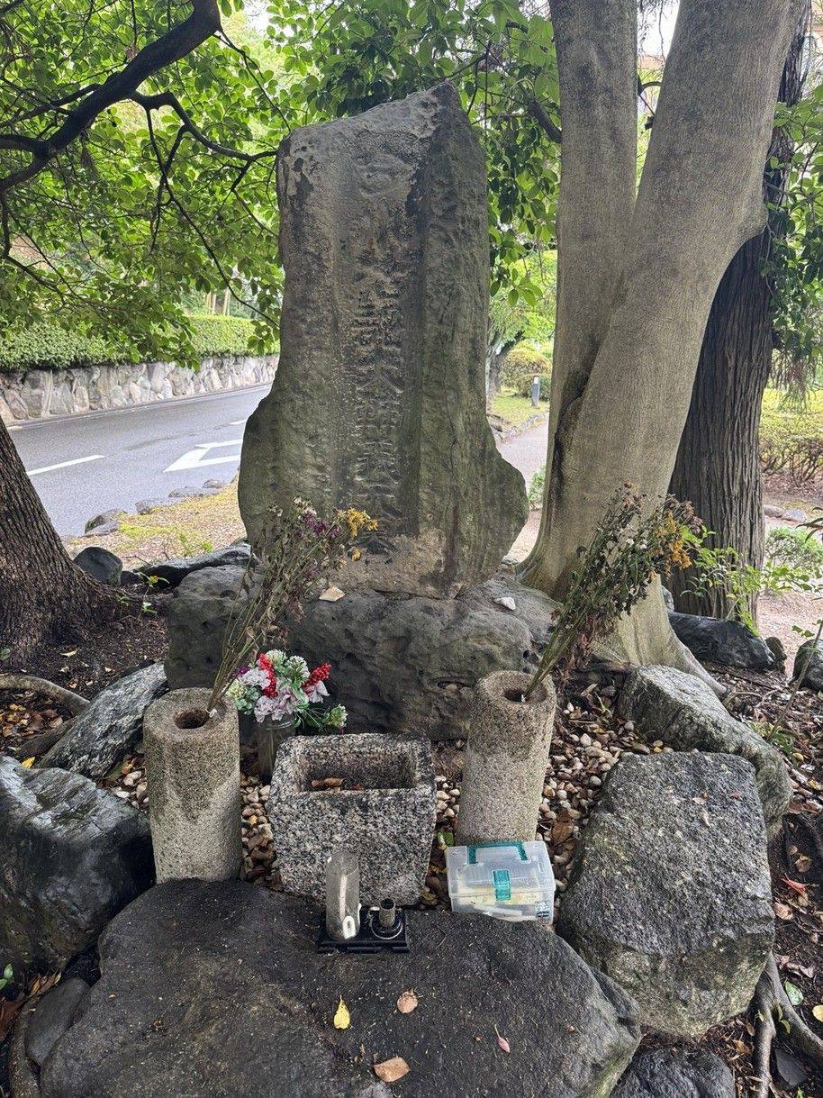
Several hundred meters away, across the modern municipal boundary in Toyoake, another landscape preserves an equally confident claim. The nationally designated Okehazama Battlefield Traditional Site contains the Nanasekihyō, seven stone markers erected in 1771. Toyoake City states that the first marker identifies the place where Yoshimoto was killed. A separate memorial to Yoshimoto was erected later, in 1876. 4
Standing there complicated everything. I could no longer simply accept the first place I had been shown because another historical tradition, itself centuries old, pointed somewhere else.
What interested me most was the terrain. The Toyoake marker sits lower than some of the ground associated with Yoshimoto's position. Looking at it from the perspective of someone trying to escape a collapsing headquarters, the location made intuitive sense to me. If Yoshimoto had been forced from his position, moving downhill would have been the fastest and easiest direction of flight.
That was not documentary evidence. It was an observation from walking the ground. But battlefield analysis begins with questions like that: If a commander is suddenly attacked, where does he move? Which direction offers the easiest escape? Where does the terrain funnel him? How far could he realistically get while surrounded by retainers and pursued by enemy soldiers?
From that perspective, the Toyoake marker did not feel unreasonable at all. Yet I kept coming back to the battlefield park. Part of that was the physical character of the site: the low ground, the water, and Nagoya's attempt to connect later land records with the marshy terrain described in the early account. My instinct leaned toward the park. But instinct is not proof.
The landscape can help test a historical account, but it can also tempt us into creating a story simply because the ground seems to fit it. Four and a half centuries of building, drainage, agriculture, and landscaping separate the terrain I walked from the terrain Yoshimoto knew. Even where the general hills remain, I cannot assume every slope, depression, or sightline is unchanged.
Perhaps Yoshimoto fell where the Nagoya park now stands. Perhaps the old Toyoake marker preserved the correct location. Perhaps the precise point lies somewhere between the certainty of both traditions. What I could say after walking both was that Yoshimoto's death no longer felt like a dot printed on a battlefield map. I could imagine a headquarters collapsing, retainers trying to hold together around him, a commander being forced away from his original position, and a fight continuing downslope until there was nowhere left to go.
The cost of the battle
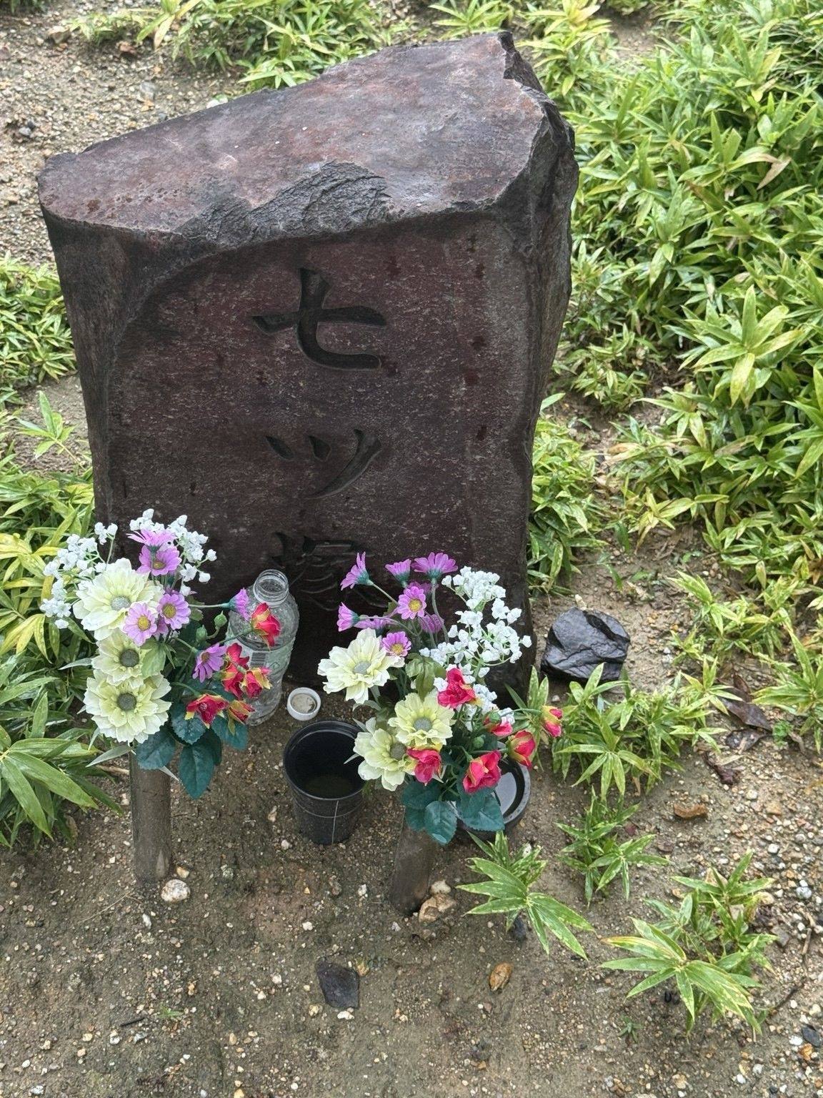
Nanatsuzuka shifted the visit from strategy to consequence. Nagoya's local interpretation says that after the fighting, villagers dug seven holes in the area and buried the war dead, creating the mounds remembered as the Seven Tombs. 2
Until that point, I had been thinking about Nobunaga's decisions, Yoshimoto's dispositions, weather, and terrain. The small stone with flowers forced a different scale of thought. Whatever the precise routes and positions were, people died here. That fact is easy to lose when Okehazama is told mainly as the miraculous rise of Nobunaga.
The battlefield was larger than Okehazama
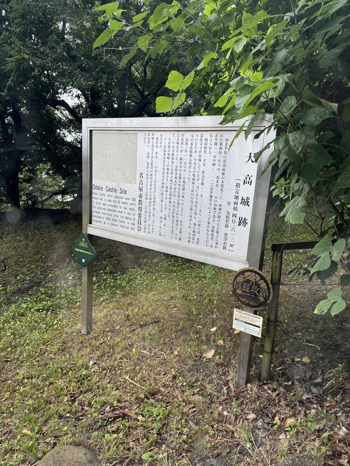
One of the easiest mistakes is to imagine Okehazama as a single confrontation centered on the place where Yoshimoto died. Nearby sites show a broader operation. Odaka Castle was already under Imagawa control, and the young Matsudaira Motoyasu, later Tokugawa Ieyasu, carried out the famous supply operation to the castle shortly before the battle. Marune and Washizu forts were part of the same strategic landscape. 5
That wider context changed the way I thought about the numerical imbalance usually attached to the battle. The popular version can make the Imagawa army sound like one enormous body concentrated around its commander, waiting to be surprised by a much smaller Oda force. But armies do not operate that neatly. Men are assigned to strongpoints, sieges, supply duties, roads, forward positions, and headquarters. Different units may be separated geographically and performing different tasks.
Seen that way, Nobunaga's opportunity becomes easier to understand. He did not have to defeat every Imagawa soldier in the campaign at the same instant. He needed to create local superiority at the point that mattered most: Yoshimoto's command group. If he could reach that group before the wider Imagawa force reacted, the total number of men in the theater mattered less than the number physically present around Yoshimoto at the decisive moment.
That does not make Nobunaga's decision ordinary. It makes it more intelligible. Okehazama begins to look less like a miracle and more like an extremely aggressive gamble against a vulnerable command position.
After Okehazama: following Yoshimoto's head
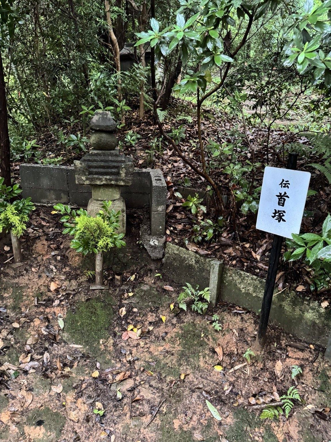
The battle did not end for Yoshimoto when he fell. His death generated another trail of traditions, memorials, and burial claims extending beyond Okehazama. That trail led me to Tōkō-ji in Nishio, where a stone structure is preserved as the traditional head mound of Imagawa Yoshimoto.
Nishio City is careful with its wording. Its historical material says that Yoshimoto, killed at Okehazama, is traditionally believed to have been buried there with fallen retainers because the temple priest at the time was his uncle. The site is presented as a tradition rather than an archaeologically established burial. 6
By then, the word traditional had become one of the most important words in the entire investigation. At Chōfuku-ji there was a tradition of identifying heads. At the battlefield park there were stories surrounding Yoshimoto's final moments and the water. At Toyoake, an eighteenth-century marker identified another place of death. At Tōkō-ji, another monument preserved a claim about what happened afterward.
None of that made the sites meaningless. It made them more interesting. Historical places preserve not only events, but also what later generations chose to remember about those events.
The battlefield that refused to stay still
By the time I finished following Okehazama, I was less certain about the battle than when I started. I considered that a success.
The simplified version is wonderfully clean: Nobunaga is outnumbered. Yoshimoto is overconfident. A storm arrives. Nobunaga hides his men, launches a surprise attack, kills Yoshimoto, and changes Japanese history. The physical battlefield resists being reduced to that story.
The hills around Kamagatani were noticeable without being mountainous. They could have affected visibility, yet I struggled to see how the modern ground alone could conceal a large force completely. At the same time, I could not know how dramatically roads, housing, vegetation, agriculture, and drainage had altered the landscape since 1560. The competing locations for Yoshimoto's death created another problem. Both made sense in different ways. Neither gave me the right to declare the question solved.
And the weather made that uncertainty more tangible. I had returned to a battlefield famous for the role weather played in its memory and interpretation. Instead of a normal rainy afternoon, I found myself walking through Okehazama during the most intense one-hour rainfall ever recorded at Nagoya's observation station. Water ran across roads and down slopes as I moved between the sites. 1
The storm I experienced was not Nobunaga's storm. Four hundred and sixty-six years separated them. Yet being outside in severe rain changed the way I thought about the problem. Maps are silent. Battle diagrams have perfect visibility. Arrows move exactly where historians draw them. People do not. Rain obscures what lies ahead. Noise changes. Footing deteriorates. Communication becomes harder. Familiar ground becomes difficult ground.
For the first time, I understood weather at Okehazama not as a dramatic sentence in a history book, but as a tactical variable. That does not prove why Nobunaga won. It simply makes the question more human.
I had gone back looking for the precise stone where Yoshimoto died, the route Nobunaga took, and an answer to which modern interpretation was correct. Instead, the field taught me the limits of certainty. I could use the ground to ask better questions. I could compare local memory with documentary evidence. I could test whether an interpretation seemed physically possible. What I could not do was force the landscape to give me an answer it no longer possessed.
The first time I visited Okehazama, I went looking for the place where Imagawa Yoshimoto died. When I returned, I learned why finding the battle was much harder.
Sources and notes
This piece distinguishes between official site interpretation, later local tradition, scholarly reconstruction, and the author's own field observations. Claims based on oral testimony are identified as such rather than presented as established fact. Field photographs and first-person observations: Noah Schuster, September 2026.
- 1Weathernews, “Nagoya de kansoku shijō 1-i no mōretsu na ame” (8 Sep. 2026). Reports 104.5 mm in the hour ending 16:53, exceeding the 2000 Tokai heavy-rain one-hour record, with Nagoya observations dating to 1890. Link
- 2Nagoya City, Midori Ward, “Okehazama shūhen no midokoro ichiran.” Used for Okehazama-yama, Okehazama Battlefield Park/Dengakutsubo, Chōfuku-ji, Nanatsuzuka, Kamagatani, and the official identification of Yoshimoto's water-drawing spring. Link
- 3Fujimoto Masayuki, Nobunaga no Sensō: Shinchō-kōki ni Miru Sengoku Gunji-gaku (Kodansha, 2003); Nagoya City Library catalog summary for Okehazama: Nobunaga no “Kishū Shinwa” wa Uso Datta (2008). Cited as a major modern challenge to the older detour-surprise interpretation. Link
- 4Toyoake City, “Okehazama Kosenjō Densetsuchi.” Records the seven stone markers erected in 1771, including the first marker identifying Yoshimoto's traditional death site, and the separate Yoshimoto memorial erected in 1876. Link
- 5Nagoya City, “Ōdaka-jō ato.” Identifies the castle as the site of Matsudaira Motoyasu's supply operation immediately before Okehazama and notes its national historic-site status. Link
- 6Nishio City historical publication, “Kira-shō de mukaeta Sengoku jidai.” Describes the Tōkō-ji site as a traditional head mound of Imagawa Yoshimoto and frames the burial as a transmitted tradition. Link
- 7On-site interpretation: Chōfuku-ji and Okehazama-area interpretive boards photographed by the author on 8 September 2026, including the kubijissho-ato and Benten Pond explanations. Oral testimony from a local woman on an earlier visit is treated as local memory, not independent proof.
See it in person
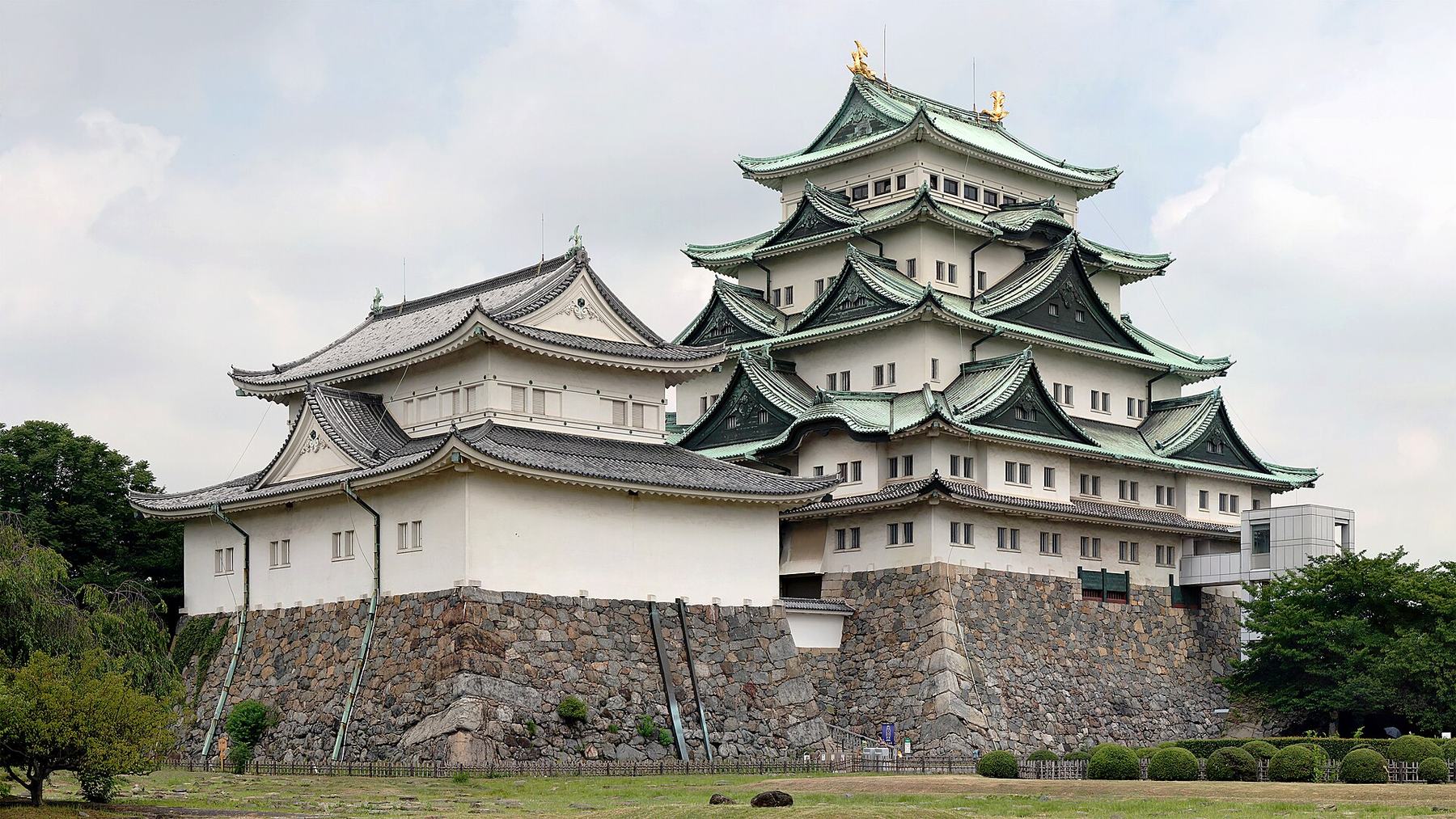
Photo: Samuel Louie, via Wikimedia Commons
Nagoya, Aichi
Nagoya Castle Historical Experience
A detailed exploration of Nagoya Castle: its architecture, its Tokugawa history, its political purpose, and the stories surrounding its construction.
- Duration
- Approximately 4–5 hours
Next in the Journal
Historical figures1534 – 1582
Oda NobunagaThe Man Behind the Demon
A son. A brother. A father. A man people loved, feared, and remembered.
6 min read